May 4, 2016
-
In Utmost Isolation
April 30, 2016, Black Canyon- This is a few days late getting to print, but here is what happened today. I started out in mid-morning, stopping in for breakfast at Flour Stone Bakery, a lovely little spot in the old mining town of Mayer, some 30 miles southeast of Prescott. It has authentic challah, and finely baked rye and other loaves of bread. I am inclined to stop here on future forays along Black Canyon National Recreation Trail, which I started walking, in segments, about 15 months ago- just north of Mayer.
Here is Flour Stone Bakery, inside and out.


It seemed that the entirety of western Yavapai County, from Prescott to Mayer, was hopping, with one form of mass entertainment or another- Bicycle Marathon, Antique Car Show and, here, just plain Antique Shows.
I needed to get back into the wilderness, though, at least for several hours. So, on to Black Canyon it was.
The segment I hiked today extended from Black Canyon City’s trailhead to Cottonwood Gulch, about 6 miles one way. It is roughly 3/8 of the Black Canyon-Table Mesa Road section of this amazing high desert system. In a nutshell, that means I have hiked a bit more than half of the entire trail (44 of 81 miles), over the past 15 months. Manageable segments work well for me, in this regard.
Here are a few scenes from along the trail, which alternates between hugging the Agua Fria and exploring the rugged hills and mesas, west of the river.

Here is a view of Horseshoe Bend, about two miles south west of the trailhead. A family was enjoying the water of Agua Fria, at this serene spot. They were among the few people I encountered this afternoon. Six bicyclists, here and there, rounded out the “companionship”. Mostly, though, it was the desert and me, alone. Plants, though, were quite prolific.
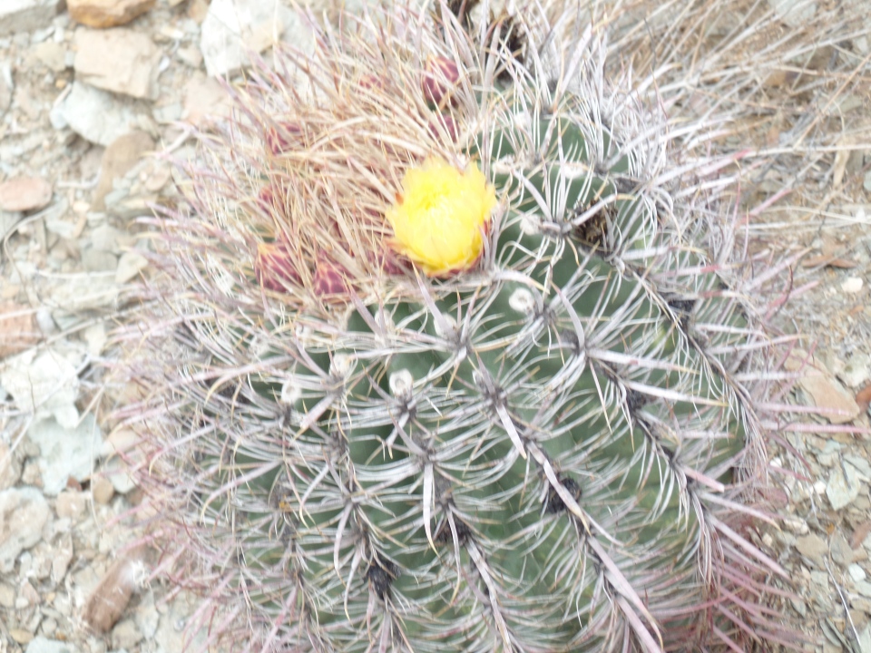
Flowering barrel cactus, Black Canyon
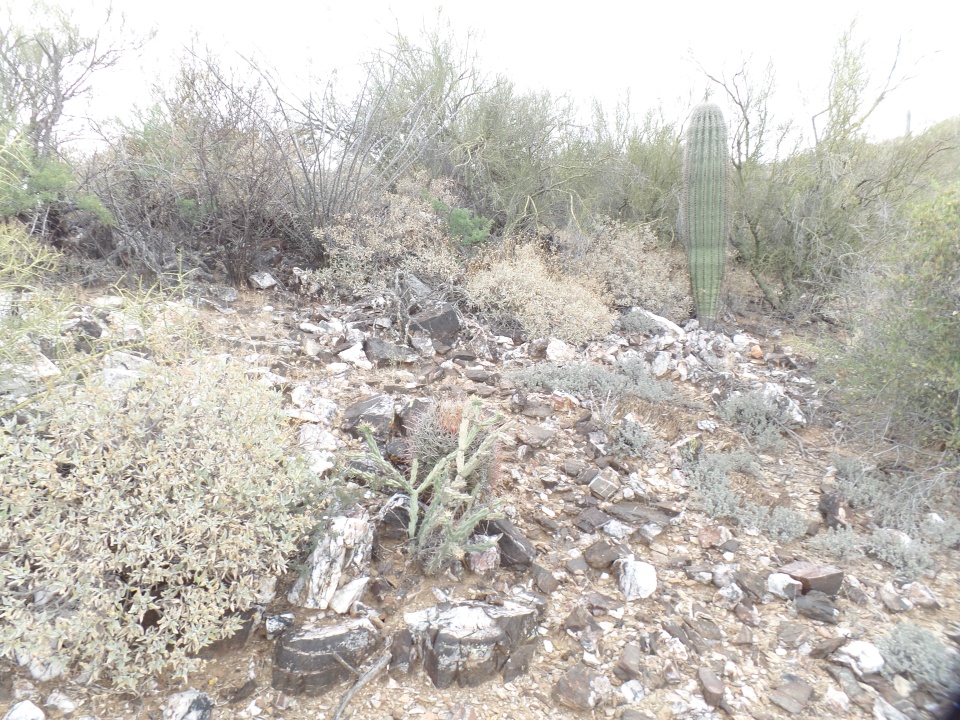
Emerging cholla, in basalt field

Mr. Sandstone
He didn’t bring me a dream, but his presence was oddly reassuring, in the quiet of the afternoon.

Hilltop bench, Cheapshot Mine region
I chose this little redoubt, atop Cheapshot Hill, to rest and write a bit in my journal. After a brief interlude here, I kept on going to Cottonwood Gulch, just shy of an intriguing Thumb Butte-like mesa, whose name escapes me. I will check that one out on my next segment hike, from Table Mesa Road, probably next Fall. Here is where I chose to turn around.

This bush reminded me a bit of mimosa, though I know it is something different- just don’t know its name. It looks like four-winged salt bush, but the flowers resemble those of salt cedar.

Desert lily, Cottonwood Gulch
Well, those last two gave me a reason to pick up a wildflower book, this afternoon.
This trail was certainly the most isolated I’ve experienced since Seven Falls, northeast of Tucson, and it was every bit as satisfying a challenge- 12 miles in a day.
.Upon returning to community life, a poetry reading and a lively jazz-funk concert rounded out this last day of April.

Heart-shaped Prickly Pear colony
Comments (6)
Hikes in the desert sound appealing right now. I think I've been to the Black Canyon. Didn't hike it. God bless your way through the desert trails!
I think taking it in segments is a good idea. I watched a movie, Wild, loosely based on a real story, of a gal who hiked the Pacific Crest trail ( after she lost her mother, her husband, and found herself with self destructive behavior, needing to make a change) . She was inexperienced at first, but ended up learning much about survival, and herself, through her sometimes harrowing experience.
Lovely. From the photos I suspect it was a bright sunny day, yes? We are at 37 degrees and it feels like 20 (according to the weather app) and it is raining. I'm going to wrap up in my blanket since we turned off the furnace after a very warm couple of days. Brrr.
@mcbery: Thanks, Miriam. I notice that there are well over 2,000 trails, in the state of Arizona.
@Crystalinne: I saw that film, also. It is common for those without ties, to set out on through-hikes of long trails. I might do that, after a few more years of work, unless there is total chaos in our land.
@murisopsis: It was intermittently sunny and rainy. I did not get soaked, but remember, this is AZ. I would not have attempted such a hike on a rainy day, east of the Mississippi.